Day 48 Wednesday July 18
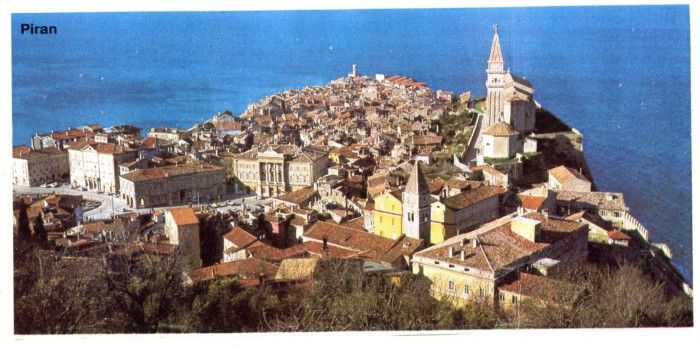
Piran. Istria, Yugoslavia. 106km. Total 2883km.
More disappearing roads, we are trying to make it into Yugoslavia, so wrong signposts are frustrating. Flat lanes, rolling straw coloured country, we feel this is a corner of Italy that has been forgotten by Italy.
Views of high mountains in Yugoslavia. Café breakfast in a town the shape of a star on the map, called Palmanova. We climb a hill towards Mont St. Michel and find what we have been missing all the way though Italy, a profusion of butterflies, blues, yellows, fritillaries, emperors, admirals, swallowtails, all seeming to flutter and flirt with each other over the flowers.
Lunch in a small meadow bounded by a hedge, looking at Yugoslavia. Signposts are few and far between and the maps not very specific. We rely on instinct. There are tunnels, and a lessening of industry, we spend our spare lira on ice cream before the border. Soon we seem to be closer to Trieste than we thought we would be and pass through the border during siesta time.
We are constantly buzzed by holiday traffic – Dutch and Germans mostly, in their thousands. At the campsite we are allocated a spiky small plot whose area includes a concrete manhole cover, which is audible all night like a stream and smells foul. A rowdy site, there is dancing and music, drunkenness.
Piran today is in southwestern Slovenia on the Gulf of Piran on the Adriatic Sea. It is one of the three major towns of Slovenian Istria. The town has much medieval architecture, with narrow streets and compact houses. Piran is the administrative centre of the local area and one of Slovenia’s major tourist attractions. Until the mid-twentieth-century Italian was the dominant language, but was replaced by Slovene as populations moved.


